
Elevation: 3033m
Elevation Gain 3000m Total
Distance 30km roughly from Aspiring Hut. 9km from Carpark to Aspiring Hut.
Access: Raspberry Flats Carpark. About 50km from Wanaka.
Difficulty: 4th Class Climbing with potentially the occasional 5th class step but we didn’t run into any 5th class. Glacier travel, steep snow, and route finding. I would say that Mt. Aspiring isn’t particularly hard in any aspect but challenges all facets of mountaineering.
Note: The weather is the crux of Mt. Aspiring. Poor weather turned us around twice so I recommend waiting for a broad weather window. This is a West Coast mountain so it can turn volatile in marginal weather conditions.
There are enough accurate route descriptions out there and I figure the only way I’ll properly write this is if it’s through a stream of consciousness. The directions I’m giving are as if I’m telling it to an amateur mountain enthusiast like myself.
Description:
Mt Aspiring should be on every mountaineer’s list when climbing in New Zealand. It takes you through every landscape and constantly changes. We climbed via the Kangaroo Patch. We managed to use the patch in mid January but have heard that it can melt out prior to that. The Kangaroo Patch drastically reduces travel time on the mountain as the lower south-west ridge is very broken and this route bypasses it.

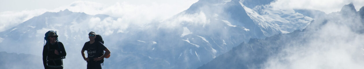
The approach is up the West Matukituki. You’ll follow a very busy farm track for the first 9km until you reach the Aspiring hut. BIKE IT. Even if you own a cheap commuter bike it seriously makes a difference. Travel time by bike is somewhere around 45 min if biking with intention. Walking can be around 2 hrs. From the Aspiring Hut you walk for 5km through the popular and well-maintained track to the turn off for French Ridge. This valley is still my absolute favourite in New Zealand. The landscape is absolutely stunning. There is now a bridge that crosses the river to reach the start of the French Ridge track. You are gonna blow right past that and keep walking into the forest. There is a much less travelled track to the back of the valley. This forest section will be the mental crux of the climb on the way back.
It’s only about 40 minutes to make it through the forest to the scrubby backside of the valley. There are markers that will help you navigate to the back of the valley. The track deviates from the river a few times and heads into the scrub. There will be some level of route finding back there but it’s relatively straightforward walking. If you get stuck just turn around and try a different path. Near the back of the valley there is this big boulder that looks like a large tombstone. Aim for there before heading to the obvious waterfall at the back of the valley. Track up a scrubby hill until you hit a loose scree slope. Aim for the waterfall and once you hit the slabby rocks you should be able to find a trail that takes you into the guts of the waterfall. (Waterfall is a stretch. It is a steep, shallow creek that cuts into the headwall of the valley)
Now you’ll need to pay attention. This next section is not technically tough but can easily cause problems if you don’t keep your eye on the track. There is a ridge that cuts up on the right hand side of the waterfall. Cairns mark the start of the track but the rest is up to you. This is classic wet, grassy slab. The trail will zigzag upward toward the ridge. If it seems too steep you’ve gone too far left. Anytime you lose the track, aim up and right. It basically wants to follow just under the proper ridge. Many people say this is the hardest part of the route and it is simply due to the navigation. It can be very easy if you are careful. You’ll know you’re on the right path on the upper half as you will pass a handful of rappel bolts. Don’t be scared, these are there for early season or bad weather. Under somewhat dry conditions this is a very easy segment.
The waterfall section finishes and the top of a bluff and a large clearing. For a time there is a trail that aims for the obvious big bluff leading to Bevan Col. If you lose the trail just aim for the same creek you used in the waterfall. If you have a good gander you will see some rock bivies. They are a perfect spot to start if you want to climb in 2 days instead of 3. Pretty minimal weather protection though. Walk past the bivy rocks head toward the creek on the left. There is a track if you look hard enough. Before entering the creek where the goat track wants you to you can just scramble up the bluff on the left. You’ll know it’s the right one if you can climb it. If you can’t then it’s not and maybe just follow the creek, up the snow until you see the easy trail instead.
Once you are on the bluff, follow the cairns laterally across the mountain. You’ll crawl into this little creek and back up the other side. After you do this you can aim straight up at the rock ridge. It is very easy mountain travel and an army of cairns will tell you that you’re on the right track. Remember, you are responsible for your own navigation. If something seems off it’s important to stop and have a look around. You’ll follow mellow rock slabs and dirt paths until you link up with the snow. If it’s late in the season it will just be rock the whole way. If it’s a good weekend there will probably be footprints in the snow. If not, you can just follow the snow slopes. The easiest way is to probably just follow the snow around the rock bluff in the middle to the left. When it levels out you can cross the rock bluff and at that point you’ll be in Bevan Col.

January on the Bonar Glacier. No signs of Crevasses but they’re there.
You’ll see the Bonar Glacier as you pass through the col. It’s massive, flat, and in early season looks pretty harmless. I’m sure it is but I still think that it really doesn’t hurt to rope up. There are crevasses throughout the glacier and from experience they can be 3-4ft wide and bottomless. Keep an eye out for the Colin Todd hut. The snow access to the hut uses a face to the right of the hut. It looks steep from the Bonar glacier but is quite mild when using it. When we passed by it there was a lovely cornice sitting above the route. Bevan Col is a great spot to draw a plan for the Kangaroo Patch. If you are planning to climb it from a camp near bevan col you can just skip visiting the hut as the route doesn’t pass it.

Colin Todd Hut. You’ll use this way if you’re planning to climb the full NW ridge.
From the Bonar Glacier, you head up and right above some cliffs. You will reach this massive, open moderate snowy face. We had 3 different paths from other parties when we showed up. If there are no paths you are just trying to end up just beneath the Kangaroo patch. We travelled across the face a fair way until we were beneath the patch and climbed a couple hundred metres straight up at it. It is steep but when we climbed we were holding the pick of the ice axe and using jamming the handles into the snow like walking poles. There is an obvious crack where the seasonal snow of the kangaroo patch and the glacier start to separate. You’ll travel climber’s right around that. We had a second crack we had to climb into and pull ourselves up on the other side. From here you’ll follow steepish snow to the ridge just below the buttress.

Jordan on the standard terrain on the buttress. As you can see it’s actually rather broad.
I feel like I was most nervous about the buttress but if you have a decent amount of scrambling experience you need not worry. It’s a mix of 2nd-4th class with maybe one or two 5th class steps. From where the snow hits the ridge you’ll move up and to the left/ sunny side of the ridge. The crux here is route-finding. There are dozens of ways through the buttress but you’ll just follow a trend of aiming up along the ridge at like a 45 degree angle. From memory, the buttress is quite tiered so I never felt it was too exposed. Follow along loose tiers and snow patches on the ridge until you eventually meet up with the proper ridge. It’s important to keep track of your route up as following the same way back will make life a lot easier going down. There are topo apps that don’t cost a lot that can track your route. It’s no big deal if you don’t track as there are many landmarks and more than one way back to the Kangaroo Patch.

This is the standard terrain for the rest of the route. It is 2nd class until you reach the snowcap.

Photo of me on the snowcap. The angle gets no worse than this.
From the top of the buttress the rest of the route is very simple. It’s a long, broad ridge that climbs consistently until the summit is reached. It feels never-ending. It literally never ends. Just one foot in front of the other for like 600 vertical metres. the snowcap was a relief as we could use the crampons again. The snow was firm when we hit the snowcap so travel was very easy. Eventually the snow just rolls over and you’re left with what I believe must be one of the greatest views in New Zealand. The views are stunning from any direction. We had inversions in the valleys and blue skies above. The peaks all poking through the ocean of clouds.

Jordan on the Summit


When you’re done soaking up your views you just follow your steps back to the start. Be careful of soft snow. We left our camp above the waterfall at 2:30am and reached the summit at 8am. We were back at camp around 12:30.